- Petr Pridal founded MapTiler in 2015 in Zug, Switzerland.
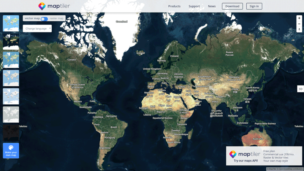
- The company offers smart digital highly customizable maps.
- MapTiler combines satellite data from Copernicus Sentinel-2 and Airbus with open data aerial imagery from local governments.
Hundreds of enterprises are using maps on their websites and in their mobile apps. Some of them, including IBM, NASA and BBC have, however, switched from using Google Maps to using maps from MapTiler. And why?
MapTiler allows its clients who need cartography on their websites to create smart digital maps that are highly customizable. Rendering and impressively fast processing of huge raster maps takes arguably less time with MapTiler, according to a customer feedback from Vodafone.
MapTiler is a sub-organization of Klokan Technologies GmbH from Switzerland which was founded 7 years ago. The product itself has been on the market for only a year and has already gained much praise from its clients.
The generated maps are based on the open data and do not contain any advertisements. But what makes it stand out among its competitors is the price and the fact that they are available either online or offline behind the firewall.
MapTiler Is Able to Process Aerial and Satellite Imagery or Geodata of Any Size
The startup is combining terabytes of satellite data from Copernicus Sentinel-2 and Airbus with open data aerial imagery from local governments. From transportation and agriculture to weather companies, MapTiler maps serve as a base for their apps.
Any company can embed and customize maps on their websites or mobile apps with the open-source APIs. Additionally, the solution allows a high degree of customization. This allows the customers to choose from basic map designs and customize them directly in MapTiler’s built-in editor. It further allows them to change the language or colours of the maps to match their brand.
The startup also offers MapTiler Desktop – a software for converting data into fast zoomable maps. It can load any image or geodata and get a tiled map which can be uploaded to MapTiler Cloud.
Last, but not least, one can also create maps using drone footage or simply photos from a trip with a hot air balloon. The main condition for creating high-quality maps is that the images must overlap. MapTiler will do the rest.
In the future the company is hoping to acquire more customers primarily from the US and western European market.